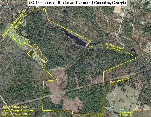
One of my favorite and most useful tools in the land business is an aerial photo. It provides so much information about a property, showing its shape and features like open vs wooded land, timber types, roads, creeks, rivers, ponds, and the makeup of neighboring properties. It’s also an invaluable tool in planning farm, forestry, and wildlife management operations. Continue reading “Aerial Photos”