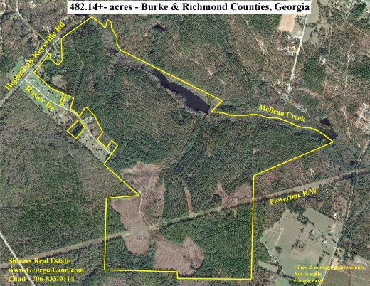
One of my favorite and most useful tools in the land business is an aerial photo. It provides so much information about a property, showing its shape and features like open vs wooded land, timber types, roads, creeks, rivers, ponds, and the makeup of neighboring properties. It’s also an invaluable tool in planning farm, forestry, and wildlife management operations. Continue reading “Aerial Photos”
Blog
Georgia’s Conservation Use Assessment Covenant
December 1, 2016
If you own farm land, timber land, or recreational property, and you have no plans to develop your property into a residential or commercial use in the next 10 years, you may want to look into Georgia’s Conservation Use Assessment Covenant. It’s a great way to save a substantial amount of property tax every year.
From the Georgia Department of Revenue’s website: “This favorable tax treatment is designed to protect property owners from being pressured by the property tax burden to convert their land from agricultural [or other qualifying] use to residential or commercial use…” In other words, it’s intended to be an incentive to keep undeveloped land undeveloped.
Continue reading “Georgia’s Conservation Use Assessment Covenant”